A fact sheet to support the Soil CRC’s ‘Digital soil mapping, visualisations and data integration’ webinar, delivered as part of our ‘Building technical capacity for improved soil management’ webinar series.
In this webinar, Dr Michael Roach from the University of Tasmania provides a fascinating look at:
- the latest technologies being employed to capture and render landscape and soil data
- visualising a soil pit from a hole in the ground to a high-tech 3D soil pit
- the world of virtual tours, and the integration of geospatial data in Geographic Information Systems (GIS) for effective soil mapping and outreach.
The aim is to enable remote viewers to better appreciate landscapes and specific features like a soil pit. Virtual tours, like the one demonstrated in the webinar, offer an intuitive platform for outreach, education, and conveying complex soil and landscape information to diverse audiences.
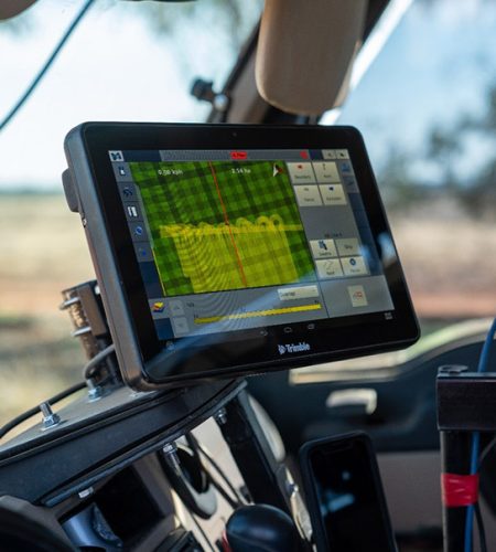
Utilising Geophysical Data In Soil Mapping
Geophysical data, such as gamma ray surveys, provides valuable insights for soil mapping and identification of soil variation before digging a hole. These surveys map variations in gamma ray emissions from the Earth’s surface, offering detailed information down to approximately 30 cm depth. This depth is necessary for understanding the region relevant to root growth for crops, identifying variations in soil character.
Electromagnetic data assists in mapping subsurface variations in electrical conductivity, important in regions prone to dryland salinity. It aids in assessing soil variability and suitability for agriculture.
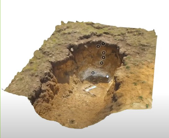
Enhancing Soil Exploration With 3D Models
Utilising digital photogrammetry, 3D models offer a dynamic and detailed representation of soil pits. The process involves capturing images from different angles, creating a point cloud, generating a triangular model, and texture rendering.
Quality photography is crucial, with the guideline of having each object appear in a minimum of three separate images taken from different directions. Model sharing is facilitated through online platforms like Sketchfab, allowing collaborative exploration and annotation of 3D representations.
360-Degree Imagery: Providing Context
360-degree imagery offers a unique way to visualise landscapes. It provides context, allowing stakeholders to understand the terrain and its relationship to soil properties. With consumer-level 360-degree cameras, collecting imagery has become effortless.
Enhancing Communication With 3D Technology
In the realm of soil science, leveraging 3D technology within tools like QGIS opens avenues for effective communication. Integrating 3D panoramas and soil pit models allows users to navigate the landscape digitally. The 3D soil pit models, annotated with expert insights, provide a rich learning experience, enabling widespread knowledge sharing.
Conclusion
Digital soil mapping is a powerful tool for soil knowledge brokers and stakeholders in agriculture. By integrating data from various sources, including geological databases, elevation data, and geophysical surveys, we can create comprehensive visualisations and maps of soil profiles. This approach enhances our understanding of soil dynamics and aids in informed decision-making for sustainable soil management and agriculture practices.