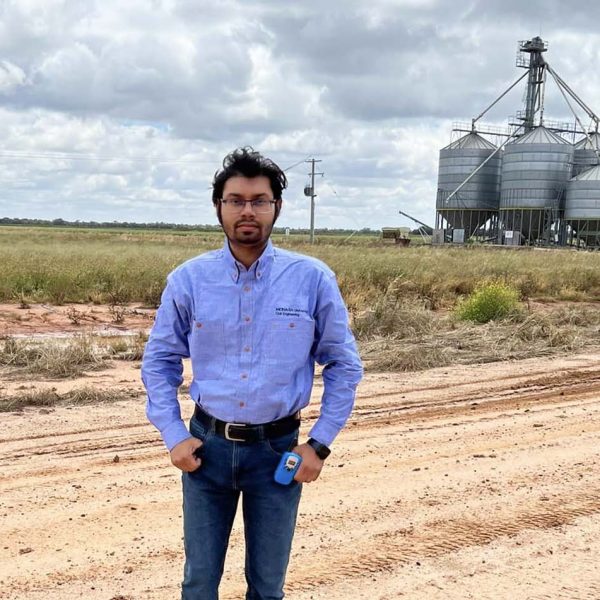
PhD Student Profile

Dr Dristi Datta
Charles Sturt University
A quick snapshot
Research focus: Remote sensing, image processing, earth observation, learning-based AI models, soil property estimation, vegetation–soil interaction, multispectral/hyperspectral modelling.
PhD completed: 2025
Supervisors: Dr. Manoranjan Paul (Charles Sturt University), Dr. Manzur Murshed (Deakin University), Dr. Shyh Wei Teng (Federation University) and Dr. Leigh M. Schmidtke (Charles Sturt University)
About Dristi’s research
Prediction of different soil auxiliary properties (e.g. soil moisture, carbon, nitrogen) is a significant field of study, as these properties directly influence plant health, crop growth, and sustainable food production. Traditional estimation techniques such as oven-drying and chemical analysis are accurate but time-consuming, costly and limited to small land areas.
With the rapid advancement of remote sensing technologies such as satellite sensors and multi or hyperspectral imaging, soil properties can now be estimated non-invasively and cost-effectively across large expanses of bare soil. However, in real agricultural settings, stakeholders also require soil information under vegetation-covered conditions to make timely decisions related to fertiliser application, irrigation, or yield estimation during the growing season.
My research addresses this challenge by developing learning-based decision support systems that use remote sensing imagery of vegetation canopies to infer underlying soil properties. The core idea is that vegetation health patterns carry signatures of soil conditions, enabling soil assessment even when direct soil visibility is limited.
In the early phase of the project, I evaluated multiple ML and DL models using lab-based hyperspectral datasets to establish the upper-bound performance of hyperspectral reflectance for predicting auxiliary soil properties. Building on this, I explored satellite datasets (Landsat 8, Sentinel-2) to predict soil properties over large, mixed landscapes (bare and vegetated), and assessed their feasibility compared to controlled hyperspectral conditions.
My PhD developed several novel AI-based methods — including hybrid attention models, noise-correction frameworks, and GAN-based vegetation interference removal — to enhance soil organic carbon prediction under both bare-soil and vegetation-covered environments. Together, these contributions support the development of a practical satellite-driven system for large-scale soil assessment.
More about Dristi
What interested you about this sort of research?
The interdisciplinary nature of this research captured my interest from the outset. Combining principles from remote sensing, machine learning, and soil science enabled me to explore novel approaches for soil assessment that bridge the gap between traditional laboratory methods and large-scale field applications. The prospect of developing practical tools that address the needs of agricultural stakeholders continues to motivate me to push the boundaries of current knowledge.
What do you love about soil?
Soil, to me, represents the foundation of life. Its complexity and diversity fascinate me, as it serves as the medium through which plants grow and ecosystems flourish. I admire how soil embodies a delicate balance of physical, chemical, and biological processes, and I am driven to understand and protect this essential resource for future generations.
What did you love about your PhD?
What excited me most about my PhD was the opportunity to harness cutting-edge technologies like satellite remote sensing, hyperspectral analysis, and learning-based AI models to tackle real-world agricultural challenges. I am passionate about developing innovative solutions that can transform how we assess and manage soil health, contributing to sustainable agriculture and improved food security.
How will your PhD help to make a difference for farmers or other end users?
My research aims to provide farmers and stakeholders with a reliable decision support system capable of predicting soil properties in both bare and vegetation-covered areas using remote sensing imagery. By enabling non-invasive, timely, and cost-effective soil assessment, this work supports improved fertiliser management, crop monitoring, yield prediction, and sustainable land-use planning — helping farmers optimise productivity while minimising environmental impact.
What do you want to do now that you have finished PhD?
I aspire to continue working at the intersection of agriculture, technology, and environmental conservation. Through my academic roles and ongoing research, I aim to develop practical AI-driven solutions that address critical challenges in sustainable agriculture and soil monitoring, contributing to a more resilient and food-secure future.
Dristi’s publications
- Datta, D., Paul, M., Murshed, M., Teng, S. W., & Schmidtke, L. (2022). Soil Moisture, Organic Carbon, and Nitrogen Content Prediction with Hyperspectral Data Using Regression Models. Sensors, 22(20), 7998.
- Datta, D., Paul, M., Murshed, M., Teng, S. W., & Schmidtke, L. (2023). Comparative Analysis of Machine and Deep Learning Models for Soil Properties Prediction from Hyperspectral Visual Band. Environments, 10(5), 77.
- Datta, D., Paul, M., Murshed, M., Teng, S. W., & Schmidtke, L. M. (2023, November). Novel Dry Soil and Vegetation Indices to Predict Soil Contents from Landsat 8 Satellite Data. In 2023 International Conference on Digital Image Computing: Techniques and Applications (DICTA)(pp. 152-159). IEEE.
- Datta, D., Paul, M., Murshed, M., Teng, S. W., & Schmidtke, L. (2024). Unveiling Soil-Vegetation Interaction: Reflection Relationships and an Attention-Based Deep Learning Approach for Carbon Prediction. In 2024 IEEE International Conference on Multimedia and Expo Workshops (ICMEW).
- Datta, D., Paul, M., Murshed, M., Teng, S. W., & Schmidtke, L. M. (2025). Hybrid Bayesian Attention Model for estimating soil organic carbon from Landsat 8 satellite data. Computers and Electronics in Agriculture, 237, 110406.
- Paul, M., Datta, D., Murshed, M., Teng, S. W., & Schmidtke, L. M. (2025). Transformer-Guided Noise Detection and Correction in Remote Sensing Data for Enhanced Soil Organic Carbon Estimation. Remote Sensing, 17(20), 3463.
- Datta, D., Paul, M., Murshed, M. Teng, S.W., & Schmidtke, L.M. “ReflectGAN: A Novel Approach for Soil Carbon Estimation in Vegetated Lands.” (Under Review: IEEE Transactions on Geoscience and Remote Sensing, Available at: https://arxiv.org/html/2505.18546v1)
Find out more
- Related article: Harnessing technology to solve complex problems
2024 PhD presentation: Developing an imagery-based decision support system for soil assessment
2025 research poster: ReflectGAN: Modeling Vegetation Effects for Soil Carbon Estimation from Satellite Imagery
