Dr Peter Weir’s Soil CRC PhD research led to the development of a new tool that reveals spatial variations in rainfall over short distances, providing farmers with an unprecedented level of detail about rainfall on their properties.
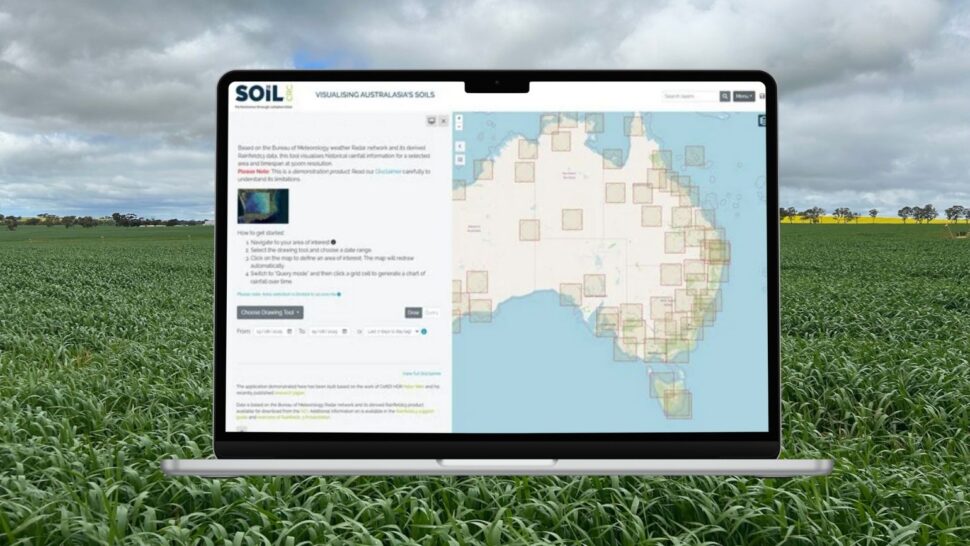
Based on Dr Weir’s research, the Rainfall Mapper is a standalone, online application, developed by the technical team from Federation University’s Centre for eResearch and Digital Innovation (CeRDI). It enables users to select tiles that are 500 by 500 metres for specific locations and time periods – allowing the tool to be used by farmers to gain greater insight into rainfall information specific to their property.
Rainfall Mapper gives farmers increased access to information about past rainfall, enabling them to make more informed decisions about crop planning and irrigation strategies.
The tool is available to the public on a trial basis through the Soil CRC’s Visualising Australasia’s Soils (VAS) soil data portal. The trial will help the CeRDI research team gain a deeper understanding of the varied, practical applications of the tool. This will enable them to optimise the value of the tool for different users and to improve the user experience.
Dr Weir’s PhD research involved determining soil moisture content at the paddock level and investigating the spatial variation in rainfall within an area, which guided the development of the app.
“It is an area measurement – not a point measurement from a single location and that means the app has the capability of picking up rainfall details of localised thunderstorms that often occur unmeasured between official Bureau of Meteorology gauges,” Dr Weir said.
Regional rain gauges are sparsely located with an average distance of around 30-50 kilometres between these single-point measurements.
“We’re very careful with our disclaimer because the rainfall amounts are dependent on the modelling of the weather radar signal to estimate the amount of rain that has fallen in that specific area, but the results are extremely interesting.”
Rainfall Mapper uses data sourced from the official Bureau of Meteorology (BoM) rain gauge network from across Australia, merged with the BoM’s weather radars to generate the Rainfields3 dataset, which is available online from National Computational Infrastructure, a high-performance data, storage and computing facility.
Soil CRC Project Leader and CeRDI Principal Research Fellow, Associate Professor Peter Dahlhaus, led the Rainfall Mapper project and said there are many potential uses for the app, which presents already available information in a user-friendly way.
“If you’re a farmer and you want to seed your paddock, you would like to know how much rain you’ve had since the last harvest, and when and where the rain has fallen,” Associate Professor Dahlhaus said.
In addition to farmers and others working in agriculture, he anticipates strong interest from people involved in catchment management, those living in high-rainfall areas and biodiversity groups.
“The resolution is so much finer than any other tool that is available and rainfall patterns have shifted due to climate change. Instead of getting normal reliable winter rain, we’re now getting more scattered intense rain events and scattered showers.”
Associate Professor Dahlhaus said the CeRDI research team is currently taking the Rainfall Mapper tool to the next stage, which is to convert the rainfall data into soil moisture at a finer resolution than they have previously been able to.
“The important point is not just the rain that has fallen on a specified area – this is valuable information – but a lot more interest will come when people are able to say how much water is in the bucket.”
Soil CRC CEO, Dr Michael Crawford, is keen to highlight the usefulness of this information to soil management.
“Even though the product is about rainfall, the Soil CRC wanted to support Peter’s research because of its relevance to soil management. Available soil water is dependent on many soil parameters, but ultimately rainfall is a key driver.”
“Knowing how rainfall distribution varies across a farm in any rainfall event helps to improve soil management and soil performance.”
Acknowledgement: This article is based on a story by Federation University.