Associate Professor Peter Dahlhaus
Project Leader
Federation University
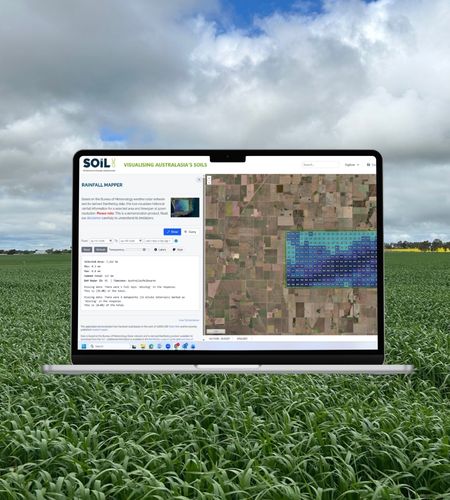
Dr Peter Weir’s Soil CRC PhD project, ‘In-Paddock Variability of Plant Available Water’, enabled paddock-scale rainfall data to be derived from the Bureau of Meteorology’s Rainfields3 product. Researchers at Federation University further developed this capability into an online application known as Rainfall Mapper, which is now a demonstrator in the Soil CRC’s Visualising Australasia’s Soils (VAS) portal.
The app combines weather radar data with rain gauge measurements to provide a detailed and spatially accurate visual estimation of rainfall distribution across paddocks and farms. Users can select tiles that are 500 by 500 metres for specific locations and time periods, enabling them to make more informed decisions about crop planning and irrigation strategies.
The challenge
While the app has received strong interest from researchers, farmers and advisors, user feedback identified three constraints that limit its current utility:
- The 10,000 ha selection cap restricts use to single properties or small farming-systems group footprints, preventing landscape, sub-catchment and group-region analysis.
- The desktop-only interaction model limits mobile access, which is often preferred by agricultural practitioners and the general community.
- The three-year temporal range prevents trend analysis, long-period rainfall characterisation and comparison against established climate records.
Our research
This project will move the Rainfall Mapper demonstrator to a production platform for sustained and expanded use. Co-design and testing will be undertaken with VAS project partners and more broadly with agriculture industry research collaborators.
Through this project, the maximum selection area will be increased to 100,000 ha, the app interface will be adapted for use on mobile phones and tablets, and the temporal range will be extended to cover the full radar archive.
On completion, Rainfall Mapper users will be able to:
- Analyse rainfall across catchments, farming-systems regions and other landscape-scale areas up to 100,000 ha – ten times the current cap.
- Use the platform in the field on a phone or tablet, supporting on-property decision-making by farmers and advisors.
- Examine rainfall patterns across a decade or more of history, supporting trend analysis, drought characterisation and comparison with established climate records.
A more spatially precise knowledge of rainfall distribution allows farmers and advisors to better estimate the soil moisture status across their farms, which is important for yield predictions and fertiliser management decisions. It also allows for greater anticipation of pest and disease risk in certain circumstances.
This tool is particularly useful when trying to estimate the impact of localised, intense rainfall events that might not be captured by official rainfall gauges spaced up to 50 kms apart.
Research outputs
Our project outputs will include a final project report, Rainfall mapper user guide and case studies.