Large amounts of previously hidden soil data in the public and private sector are being unearthed, collated and made available to improve agricultural productivity across Australia and New Zealand, thanks to ‘Visualising Australasia’s Soils’ (VAS) — a foundation project of the Soil CRC.
More than thirty people from 19 Soil CRC participant organisations have joined forces to work on VAS. It will provide Australasian farmers, agronomists, agricultural researchers and agribusinesses with relevant place-based soil information on demand.
Project leader, Associate Professor Peter Dahlhaus, says improving soil data availability will encourage new research ideas, collaborations and investment, both locally and globally. This, in turn, will help farmers with better ways to manage and improve their soil.
Dr Dahlhaus is Principal Research Fellow at the Centre for eResearch and Digital Innovation (CeRDI) at Federation University Australia, in Ballarat, Victoria.
“Soil data has previously been collected by different instruments, machines and humans, and stored in different ways in disparate places, but the projected productivity increase through digital agriculture relies on aggregating this information,” explains Dr Dahlhaus.
“By making soils data findable and accessible through clearly established rules of access and ownership, we will gain new insights into short- and long-term trends and enhance research, education and farmer decision-making.”
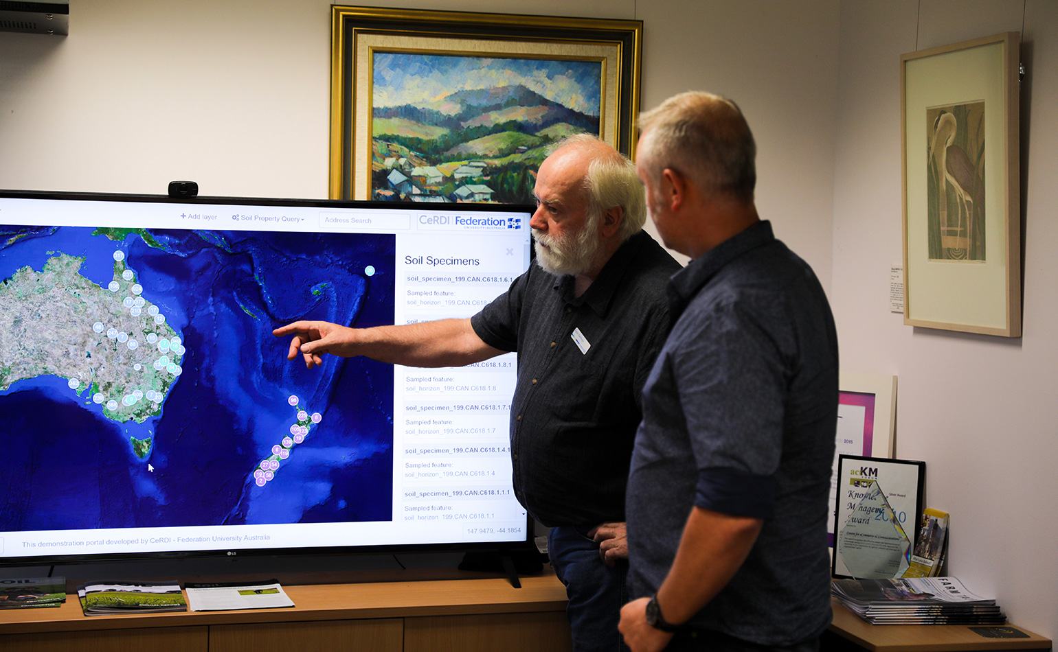
Portal permits sharing of data and access
Already VAS has produced an internet portal to enable users to load data sets, practice sharing and exchanging information, as well as test access rules that aim to protect ownership and confidentiality.
The second phase of the project will focus on providing tangible benefits to project participants.
“Soil CRC grower groups are financially supported to get together a sample dataset to put into the system, then experiment with the portal and provide feedback. What we’d like to do in the second phase is show people what they can do with the data, and how to manage it,” says Dr Dahlhaus.
“Most people want to use data for benchmarking. To find out how they compare with everyone else, and to measure trends, for example, soil carbon stocks — what potential is there for me to sequester extra soil carbon, and will it be worth my while?”
Sharing data is a social challenge, not just technical
Federating data is not just a technical challenge, he says, but a social one as well. At the start of the project, participants each had a three-hour discussion with the project team, including a social scientist, to find out what would encourage them to share data.
“A lot of people said ‘We don’t mind if you see it, but we don’t want banks or insurance companies or the government to see it’. For a system to allow this, you need fine-grained access control, a bit like blockchain, where the encryption is carried with the data and you need a key to see it,” says Dr Dahlhaus.
“We’re also finding that data literacy is quite poor in both the public and private sector. The self-serve system we use resolves that by asking the questions — Is this data yours? Do you have authority to access it? So we’re educating users at the same time.”
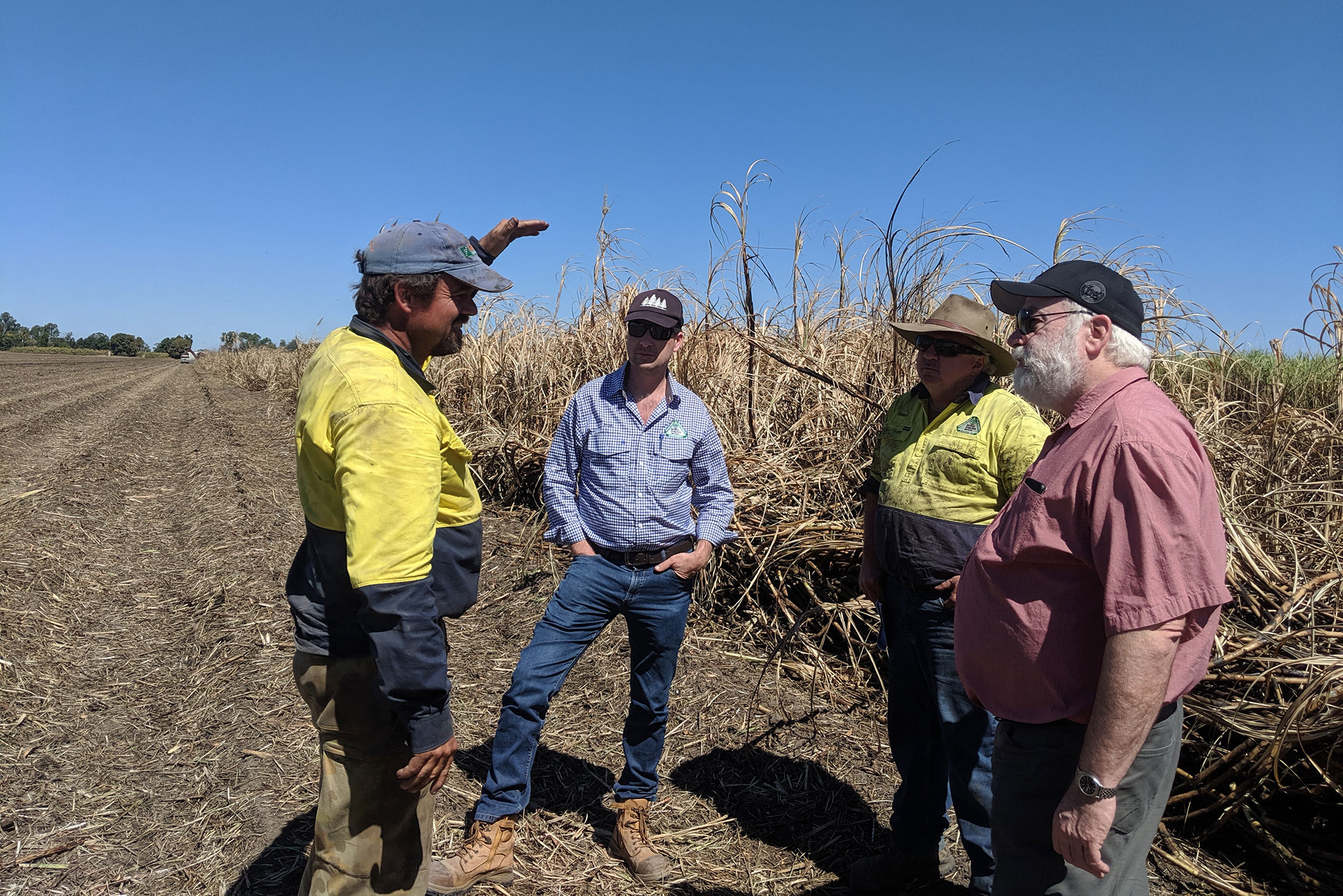
The VAS project participants include 17 grower groups and two catchment management authorities, representing regions from far north Queensland, through central NSW and Victoria, to northern Tasmania and southwest Western Australia, and includes the Riverine Plains group.
Riverine Plains happy not to ‘reinvent the wheel’
Set up in 1999 to improve the productivity of broadacre farming systems in north-east Victoria and southern New South Wales, Riverine Plains Incorporated has 350 farmer members.
“All grower groups have a lot of valuable farm data that we collect as part of our projects, but once we finish a project, it generally goes back into the folder or filing cabinet. We want to build on that data rather than reinventing the wheel,” says Riverine Plains Project Officer, Jane McInnes.
“Now that the internet portal is ready to trial, we can show farmers how their past research can be re-used to inform issues such as soil carbon and subsoil acidity, and by using GPS reference points, we can add more data to compare and visualise over time.”
Formatting and time are the key challenges for farming system groups in processing data, Jane says, as is the sheer quantity of information available, and the thorny question of who should have access to it.
“When we started VAS, it was a real eye-opener for me to see how much data we actually had and how hard it was to find. Searching through files to find soil tests from a past project can be a real challenge when everyone is so time-poor. Hopefully, it will become common practice for us to load data sets into the portal.
“There’s certain information that farmers are quite territorial about. However, they’re generally supportive of sharing soil data for the right outcome. And we can set different access for levels of information in the portal, which makes it very robust in protecting their information.
“It will also be a case of showing the research community that we have lots of data sets to build on, so rather than research going ahead independently, it will become a case of ‘I’ll check the portal’.”
Riverine Plains has already provided a soils data set to a Grains Research and Development Corporation and University of Adelaide project aiming to use machine learning for a more detailed analysis of the soil factors that impact grain yield variability.
This will include better linking of soil, agronomic and weather data with spatial information, such as remote sensing, to see whether machine learning algorithms can detect patterns in the data that traditional approaches were unable to identify.
Combining public and private soil data a ‘global first’
Dr Dahlhaus says with the advent of drones, sensors and satellites, more data is being collected today than ever before, much of it by private companies.
“If we want to maximise the value of digital agriculture, we need to have data from trusted, authoritative sources all the way from the farmer to the consumer. However, we need the ability to control who has access to the data, and under what conditions,” says Dr Dahlhaus.
“Collaboratively designing the portal tools, models and visualisations with 19 Soil CRC partners will ensure the output is a useful, everyday support tool that builds on the most current data sets and can be automatically fed into apps for decision support.”
Dr Dahlhaus says the success of the project in combining public and private soil data would be a global first.
“Australia and New Zealand have been involved in international soils and water data exchange for many years, and we’ve seen the Europeans do particularly well in accessing public data. But the public-private relationship is cutting edge — we’re not seeing this anywhere else in the world.”