Soil CRC PhD student Peter Weir began his career in irrigated horticulture in the Riverland region of South Australia—working as both a farmer and a software developer—before obtaining a degree in Information Technology (Honours) in 2012.
“My interests in soils and soil moisture management led me to commence PhD studies with the Soil CRC at Federation University’s Centre for eResearch and Digital Innovation (CeRDI) in 2020,” Peter said.
Now complete, his PhD research involved mapping field-scale soil moisture at the spatio-temporal accuracy that is relevant to farmers.
“My objective was to model reliable and fit-for-purpose estimations of the distribution of soil moisture at the sub-paddock scale.
“The soil moisture content information is at a resolution that provides individual farmers with practical information to determine management zones for agricultural decision support.”
It’s not surprising to learn that Peter enjoys using detailed logical analysis and experimentation to find practical solutions to difficult problems.
His research will help differentiate between ‘what there is to know’ and ‘what we need to know’ about soil moisture. It will enable localised prescriptive information for a farmer about their own paddock, through evaluation of risk and forecasting.
“This will assist farmers with improved on-farm management decision making by deploying the research outputs and outcomes into decision support systems that consider profit-based, not yield-based, outcomes,” he said.
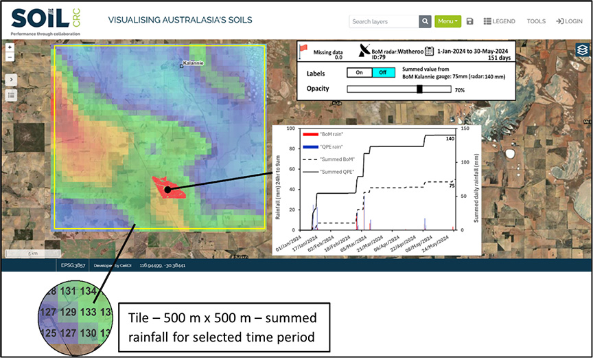
When asked what he is most proud of, Peter cites the adoption of the research he has done into the merging of weather radar and rain gauges for dryland agriculture, resulting in the development of an application for the inclusion of archival rain radar data from the Bureau of Meteorology’s Rainfields system.
“This has been one of the most complex and innovative technical work packages implemented for the Soil CRC’s Visualising Australasia’s Soils (VAS) platform,” Peter said.
“The radar data is merged with the Bureau of Meteorology’s rain gauge data to model the depth of rainfall data across the landscape in 500 m x 500 m tiles.
“The integration of the Rainfields data extends the capabilities for VAS, offering new opportunities for project partners to access weather data, mapped to regions and soil types,” Peter explained.
“Users have access to spatially mapped rainfall data and to examine their ‘patch’ and visualise the variation of rainfall patterns of intensity over time.”
To add another feather in his cap, Peter is also one of the original four inventor-developers of the EnviroSCAN soil moisture monitoring system.
“My involvement in the development of this innovative technology provided a strong background for my PhD research on in-paddock variability on plant available water,” he said.
With his PhD studies behind him, Peter is keen to continue contributing to digital agriculture research and its adoption by the farming community.
“I have been invited to join the CeRDI team to assist in implementing new soil moisture applications into the VAS portal as a part of Phase 3 of the flagship Soil CRC project,” Peter enthused.
We look forward to sharing further project news in future. In the meantime, head to the VAS soil data portal to learn more.
Find out more
Read Peter’s publications:
- Weir, P., & Dahlhaus, P. G. (2023). In search of pragmatic soil moisture mapping at the field scale: A review. Smart Agricultural Technology, 6, Article 100330. https://doi.org/10.1016/j.atech.2023.100330
- Weir, P., & Dahlhaus, P. G. (2024). Merging weather radar and rain gauges for dryland agriculture. Journal of Southern Hemisphere Earth Systems Science, 74, Article ES23023. https://doi.org/10.1071/ES23023
- Weir, P., & Dahlhaus, P. G. (2024). Beyond soil moisture probes: improving field scale soil moisture mapping. Discover Soil, 1, Article 25. https://doi.org/10.1007/s44378-024-00025-0
- Weir, P. (2024). Better understanding of within-field spatial variability of soil water. Joint NZ Society of Soil Science and Soil Science Australia 2024 Conference, 2 – 5 December 2024, Rotorua, NZ. Oral abstract.
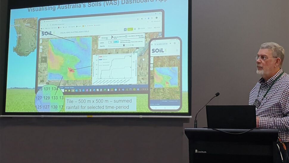
Main image: Peter Weir presenting at the recent Joint NZ Society of Soil Science and Soil Science Australia 2024 Conference, 2-5 December 2024, Rotorua, New Zealand.